เกี่ยวกับ Karttaselain
Description of the Application "Karttaselain"
Overview
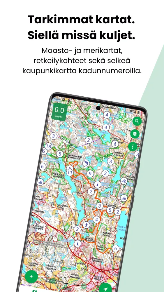
The "Karttaselain" application provides a comprehensive suite of mapping and navigation tools designed for outdoor enthusiasts and professionals alike. Whether you're an avid hiker, a casual explorer, or someone who needs detailed geographical information, this app has something for everyone.
Free Features
The free version of Karttaselain includes access to high-quality topographic maps from the National Land Survey of Finland, aerial imagery, and property information. It also offers a wide range of features such as:
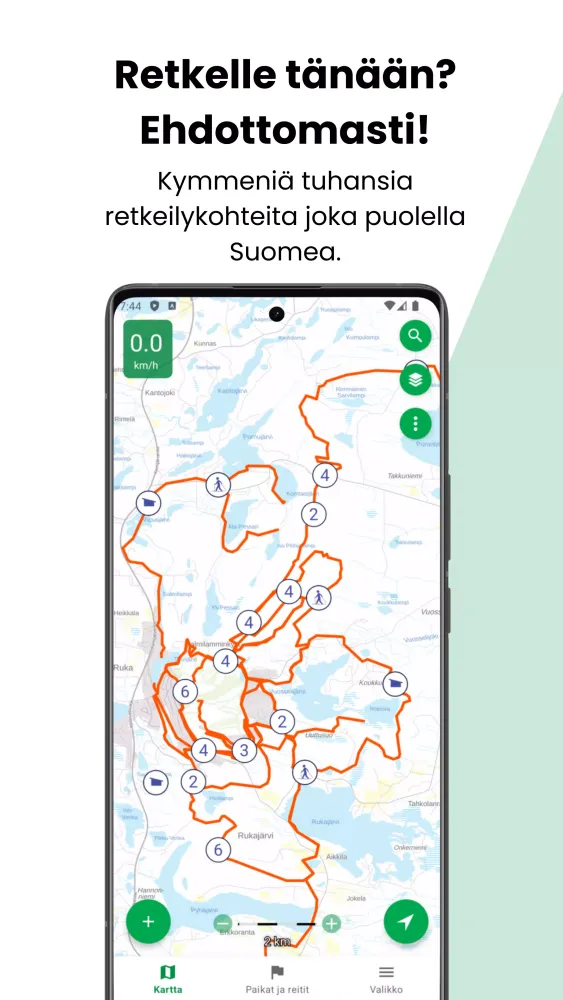
- High-resolution topographic maps from the National Land Survey of Finland
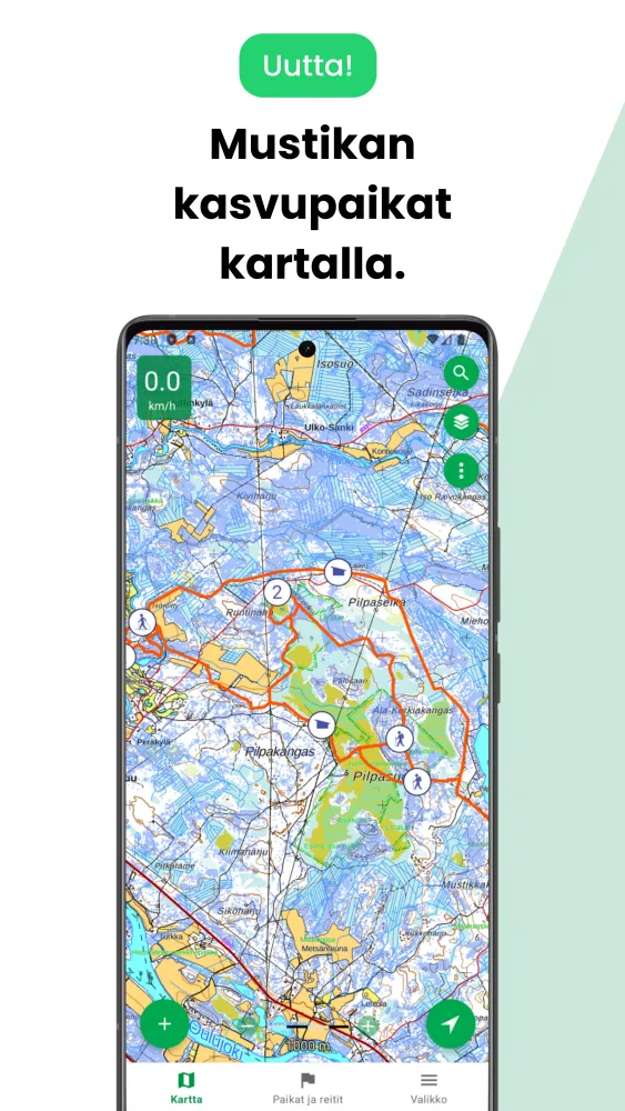
- Detailed recreational data including hiking trails, ski tracks, and motor routes
- Aerial imagery covering the entire country of Finland
- City and street maps with road names and numbers
- Detailed topographic maps of Norway suitable for outdoor activities
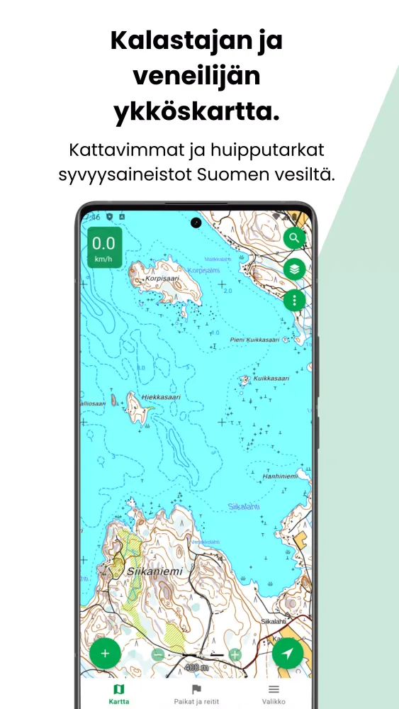
- Basic depth maps showing smaller lake depths and contours
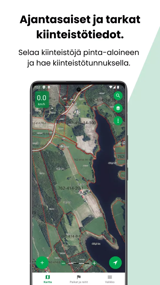
- Property boundary and ownership information updated periodically from the land registry
- Precise GPS tracking, location monitoring, and speed display (requires GPS)
- Map rotation, compass display, direction arrows, and distance measurement (requires digital compass)
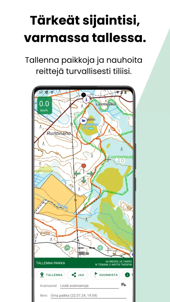
- Saving, managing, importing, and exporting your own locations and routes using keywords in GPX format
- Opening locations from other applications like geocaching apps
Plus Features
For enhanced functionality, the Plus subscription offers additional features such as:
- Advanced depth maps based on the Finnish Transport and Communications Agency's nautical chart database, ideal for boating and fishing
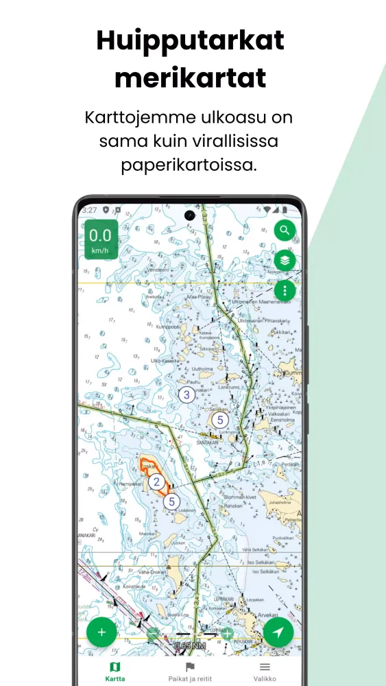
- Detailed nautical charts based on the Finnish Transport and Communications Agency's data
- Continuously updated property boundaries and ownership details directly from the land registry
- Coastal protection and forest clear-cutting images
- Secure storage of waypoints and routes in your Karttaselain account
- Automatic synchronization of locations and routes between web and mobile versions
- Route planning and area measurement
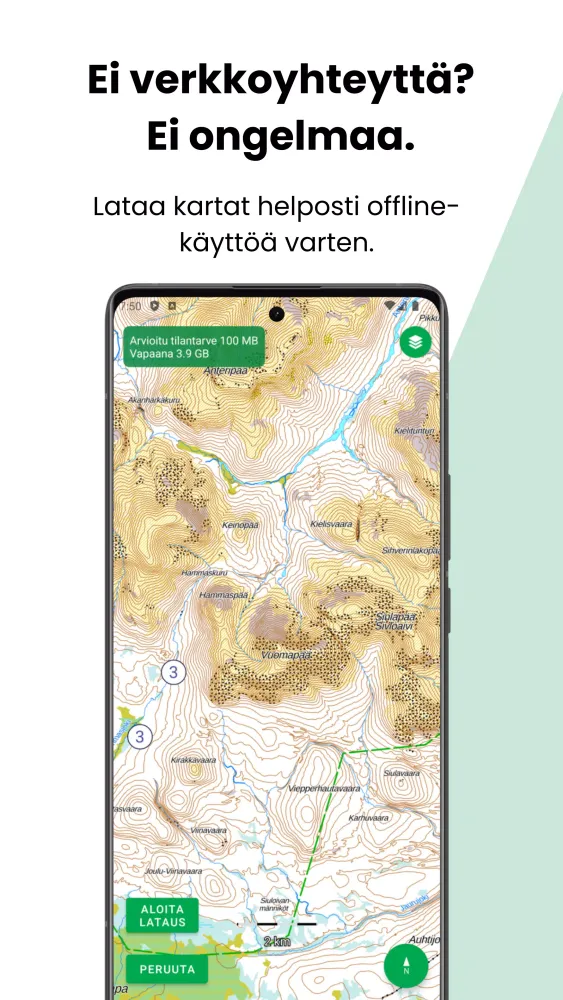
- Easy map downloads for offline use
- Tracking of beacons, dog GPS, and personal or vehicle tracking (https://www.karttaselain.fi/paikantimet)
- Addition and browsing of hunting areas for game management
- Area calculation of traveled routes
Trial Period and Subscription
Enjoy a 14-day free trial period to explore all the features of the Plus subscription. After the trial, the basic functionalities will remain free. If you wish to continue using the advanced features, you can subscribe to the Plus plan for €9.99 per 2 months or €39.99 per 12 months through the app or our website (https://app.karttaselain.fi/buy). The subscription is valid for one user across four devices. For businesses, we offer multi-user licenses; learn more at https://www.karttaselain.fi/business.
Community and Support
Karttaselain is continuously developed in collaboration with its user community. Join discussions on Facebook, Instagram, or leave reviews on Google Play. Our expert customer service team is available at https://www.karttaselain.fi/support.
Join us on this exciting journey as we enhance and expand the capabilities of Karttaselain!