
Aaland Islands - GPS map offline charts Navigator
Penilaian
Aug 31, 2017Kemas kini terkini
5.5Versi
Tentang Aaland Islands - GPS map offline charts Navigator
“Download any FlytoMap application for Free! By purchasing FlytoMap All-in-One App.”
!! Watch "Flytomap GPS" app video on www.appreview.com and www.youtube.com !!
* New in this Map: “GPS Info Page “
FlytoMap provides complete, quick and easy to use map applications for navigation for iphone. Continues in the tradition of offering depth of information and functionality across expected places all over the world, exploring the map you get maximum details obtaining detailed information of each object on the map.
Use to Explore:
“Use Latitudes and Longitudes to go to your favorite places”
“Insert the target/destination ‘Waypoint’ and see in real time your speed, distance and direction to destination”
“Insert Unlimited Markers near favorite places on the map”
“Search your Favorite points directly”
“Zoom, Rotate and Pan fast just by a finger touch”
“Navigate and see your GPS position on the map”
“Geo-Tagged photo management”
“Set On/Off Elevation Contours if you feel data is cluttering”
FlytoMap processes different types of maps for navigation for different categories:
TRAVEL MAPS:
These Maps treat you mostly with information of both Marine and terrain correspondingly. These are the most preferable Maps to travel especially for fascinating recreational voyages, map focus the best Beach spots along the Coast line, Major ports, Sailing, Fishing, Picnic areas, Parks, Hiking, Biking, Clubs, restaurants, Famous Hotels, Museums, Shopping areas, and much more. Introducing guide in map navigator for easy references, you can use it without any Active Internet connection!
WATER MAPS (Marine):
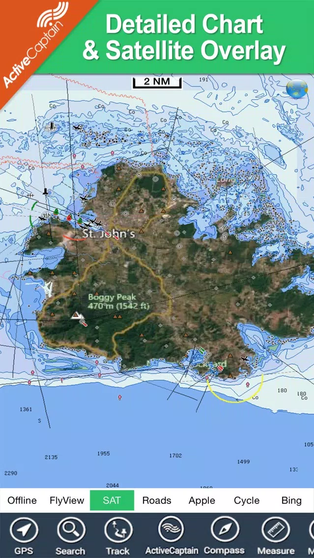
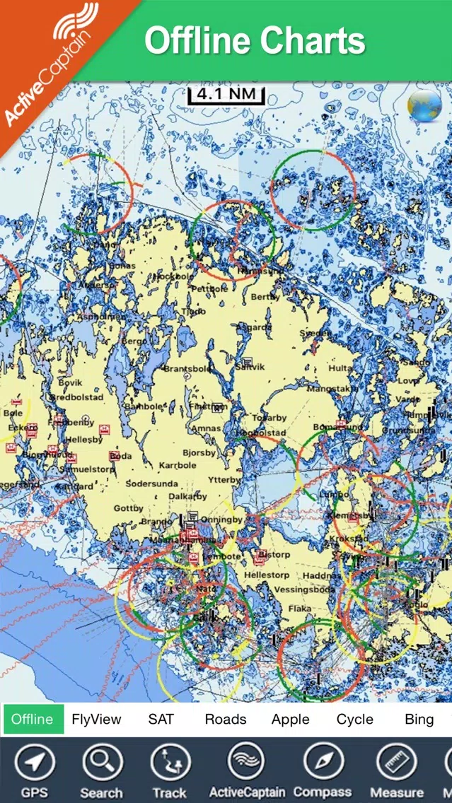
Water map navigator is the new ‘Marine Navigator for iPhone’ contains embedded Electronic Nautical Charts (ENC) from NOAA compressed to a large coverage. You can now download the application and transform your iPhone in a chart plotter with best NOAA, ENC S57 cartography; which includes Anchoring areas, Fishing areas, restriction areas, obstructions, rocks, Buoys, Beacons, Lights, Depth contours with Values display on map, Spot Soundings and more. The only marine app’s available in the market with such huge information. Every effort is made to be as accurate as possible when presenting information for every destination.
PARK MAPS:
Park map applications are extremely advanced contains embedded electronic charts with all information collected from the National Park Service and local sources. The maps contain all multiple trails (Hiking, biking, Stairway trails, Bicycle trails, Equestrian trails etc.,) and Point of interests (POI) like Campgrounds, Eating places, Ranger Stations, Picnic areas, Boat/Canoe launching, Parking areas etc., which are provided depending on the relevant park areas they exists.
“Covers all Trails, Lakes and Rivers within the Parks”
“Covers complete park boundary from (NPS)”
“Elevation Contours with 10 meters interval”
“Mountain Summits”
“All Roads and Railways from TIGER”
Introducing guide in map navigator for easy references, you can use it without any Active Internet connection!
LAKE MAPS:
We offer high quality lake maps with detailed information and important features compressed to assure the larger coverage in USA region. Lake maps contain most important DNR lakes with detailed ‘Depth Contours, Boat Ramps, Fishing spots etc. Also includes Trails, Roads and Railways information.
“We work to delight your moments”
! Enjoy great Journeys!
Note:
"Continued use of GPS running in the background can dramatically decrease battery life."
"Turn off GPS when not in use"
!! Watch "Flytomap GPS" app video on www.appreview.com and www.youtube.com !!
* New in this Map: “GPS Info Page “
FlytoMap provides complete, quick and easy to use map applications for navigation for iphone. Continues in the tradition of offering depth of information and functionality across expected places all over the world, exploring the map you get maximum details obtaining detailed information of each object on the map.
Use to Explore:
“Use Latitudes and Longitudes to go to your favorite places”
“Insert the target/destination ‘Waypoint’ and see in real time your speed, distance and direction to destination”
“Insert Unlimited Markers near favorite places on the map”
“Search your Favorite points directly”
“Zoom, Rotate and Pan fast just by a finger touch”
“Navigate and see your GPS position on the map”
“Geo-Tagged photo management”
“Set On/Off Elevation Contours if you feel data is cluttering”
FlytoMap processes different types of maps for navigation for different categories:
TRAVEL MAPS:
These Maps treat you mostly with information of both Marine and terrain correspondingly. These are the most preferable Maps to travel especially for fascinating recreational voyages, map focus the best Beach spots along the Coast line, Major ports, Sailing, Fishing, Picnic areas, Parks, Hiking, Biking, Clubs, restaurants, Famous Hotels, Museums, Shopping areas, and much more. Introducing guide in map navigator for easy references, you can use it without any Active Internet connection!
WATER MAPS (Marine):
Water map navigator is the new ‘Marine Navigator for iPhone’ contains embedded Electronic Nautical Charts (ENC) from NOAA compressed to a large coverage. You can now download the application and transform your iPhone in a chart plotter with best NOAA, ENC S57 cartography; which includes Anchoring areas, Fishing areas, restriction areas, obstructions, rocks, Buoys, Beacons, Lights, Depth contours with Values display on map, Spot Soundings and more. The only marine app’s available in the market with such huge information. Every effort is made to be as accurate as possible when presenting information for every destination.
PARK MAPS:
Park map applications are extremely advanced contains embedded electronic charts with all information collected from the National Park Service and local sources. The maps contain all multiple trails (Hiking, biking, Stairway trails, Bicycle trails, Equestrian trails etc.,) and Point of interests (POI) like Campgrounds, Eating places, Ranger Stations, Picnic areas, Boat/Canoe launching, Parking areas etc., which are provided depending on the relevant park areas they exists.
“Covers all Trails, Lakes and Rivers within the Parks”
“Covers complete park boundary from (NPS)”
“Elevation Contours with 10 meters interval”
“Mountain Summits”
“All Roads and Railways from TIGER”
Introducing guide in map navigator for easy references, you can use it without any Active Internet connection!
LAKE MAPS:
We offer high quality lake maps with detailed information and important features compressed to assure the larger coverage in USA region. Lake maps contain most important DNR lakes with detailed ‘Depth Contours, Boat Ramps, Fishing spots etc. Also includes Trails, Roads and Railways information.
“We work to delight your moments”
! Enjoy great Journeys!
Note:
"Continued use of GPS running in the background can dramatically decrease battery life."
"Turn off GPS when not in use"
Tangkapan skrin Aaland Islands - GPS map offline charts Navigator
Cadangan Editor
 Canva: AI Photo & Video Editor
 Proton VPN: Fast & Secure
 Booking.com: Hotels & Travel
 Too Good To Go: End Food Waste
 Waze Navigation & Live Traffic
 Stellarium Mobile - Star Map
 Ticketmaster-Buy, Sell Tickets
 Bolt: Request a Ride
 Life360: Find Friends & Family
 GetYourGuide: Travel & Tickets
 Sky Guide
 Doctolib - Your health partner
Aplikasi Seperti Aaland Islands - GPS map offline charts Navigator
 Aaland Islands - GPS map offline charts Navigator
 Canary Islands charts GPS map Navigator
 Azores Islands charts GPS map Navigator
 Cape Verde Islands charts GPS map Navigator
 Galapagos Islands GPS map offline chart Navigator
 FAROE ISLANDS – GPS Travel Map Offline Navigator
 PALAU ISLANDS – GPS Travel Map Offline Navigator
 BRITISH VIRGIN ISLANDS – GPS Travel Map Offline Navigator
 RAROTONGA (COOK ISLANDS) – GPS Travel Map Offline Navigator
 GALAPAGOS ISLANDS – GPS Travel Map Offline Navigator
 Lake Mead map GPS offline fishing charts Navigator
 Marine : Ireland GPS map offline charts Navigator
Aplikasi oleh Flytomap
 Real Tides & Currents Graph HD
 UK Ireland Nautical Charts HD
 AIS Maps: Marine & Lake charts
 Flytomap All in One HD Charts
 Wind forecast for Windgurus
 Florida Nautical Charts GPS HD
 Great Lakes HD Nautical Charts
 Lake Murray SC Fishing Maps HD
 Maldives GPS Map Navigator
 NOAA Buoys - Charts & Weather
 Maine Lakes - GPS fishing maps
 Minnesota Lakes Fishing Charts
Aaland Islands - GPS map offline charts Navigator FAQ
Bagaimana saya boleh memuat turun Aaland Islands - GPS map offline charts Navigator dari PGYER IPA HUB?
Adakah Aaland Islands - GPS map offline charts Navigator di PGYER IPA HUB percuma untuk dimuat turun?
Adakah saya perlu akaun untuk memuat turun Aaland Islands - GPS map offline charts Navigator dari PGYER IPA HUB?
Bagaimana saya boleh melaporkan masalah dengan Aaland Islands - GPS map offline charts Navigator di PGYER IPA HUB?
Adakah anda dapati ini membantu
Ya
Tidak
Paling Popular

ChatGPTIntroducing ChatGPT for iOS: OpenAI’s latest advancements at your fingertips.
This official app is f

Google GeminiThe Google Gemini app is an AI assistant that can help supercharge your creativity and productivity.

Claude by AnthropicGet free access to the newly upgraded Claude 3.5 Sonnet – Anthropic's most advanced model yet. Wheth

GoogleDownload the Google app to stay in the know about things that matter to you. Try AI Overviews, find

CapCut - Video EditorCapCut is a free all-in-one video editing app that helps you create incredible videos.
「Easy to use」

Shop: All your favorite brandsElevate every shopping moment
Shop, track, and explore the latest trends in an all-in-one shopping

Google MapsNavigate your world faster and easier with Google Maps. Over 220 countries and territories mapped an

Uber - Request a rideJoin the millions of riders who trust Uber for their everyday travel needs. Whether you’re running a

ThreadsSay more with Threads — Instagram’s text-based conversation app.
Threads is where communities come t

Gmail - Email by GoogleThe official Gmail app brings the best of Gmail to your iPhone or iPad with robust security, real-ti

TikTokTikTok is THE destination for mobile videos. On TikTok, short-form videos are exciting, spontaneous,

WhatsApp MessengerWhatsApp from Meta is a FREE messaging and video calling app. It’s used by over 2B people in more th

InstagramLittle moments lead to big friendships. Share yours on Instagram.
— From Meta
Connect with friends,

Netflix Game ControllerPlay games on your TV with the Netflix Game Controller.
This app connects to your TV and allows you

AirbnbTHE FASTEST, EASIEST WAY TO AIRBNB
Find inspiration, plan a trip with your group, book it, and go. Y

Telegram MessengerPure instant messaging — simple, fast, secure, and synced across all your devices. One of the top 5

Spotify - Music and PodcastsWith the Spotify music and podcast app, you can play millions of songs, albums and original podcasts

DramawaveDramawave - Stream Endless Drama Shorts, Anytime, Anywhere
Welcome to Dramawave the ultimate destina

Whatnot - Live Video ShoppingWhatnot is a social marketplace where you can discover some of your favorite products like sports ca

Google ChromeDownload the new Google Chrome for your iPhone and iPad. Now more simple, secure and faster than eve

FacebookWhere real people propel your curiosity. Whether you’re thrifting gear, showing a reel to that group

XThe X app is the trusted global digital town square for everyone.
With X, you can:
Post content for

Indeed Job SearchDiscover your next job opportunity on Indeed, the free job search app designed to connect you with b

Duolingo - Language LessonsLearn a new language with the world’s most-downloaded education app! Duolingo is the fun, free app f