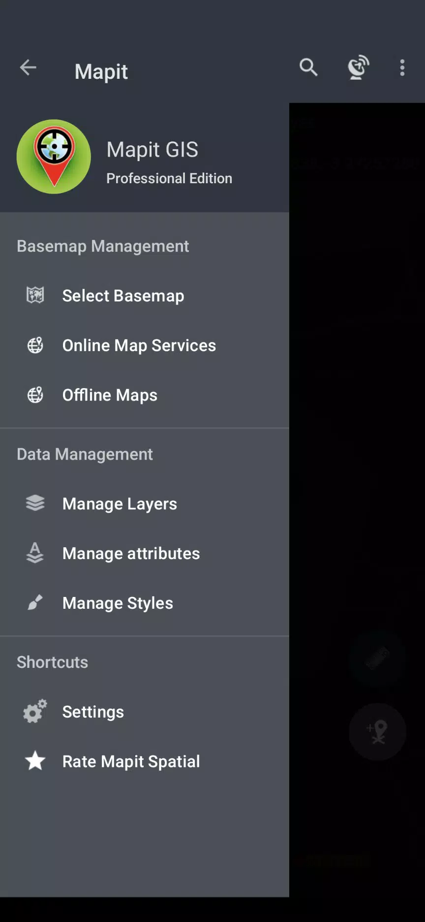
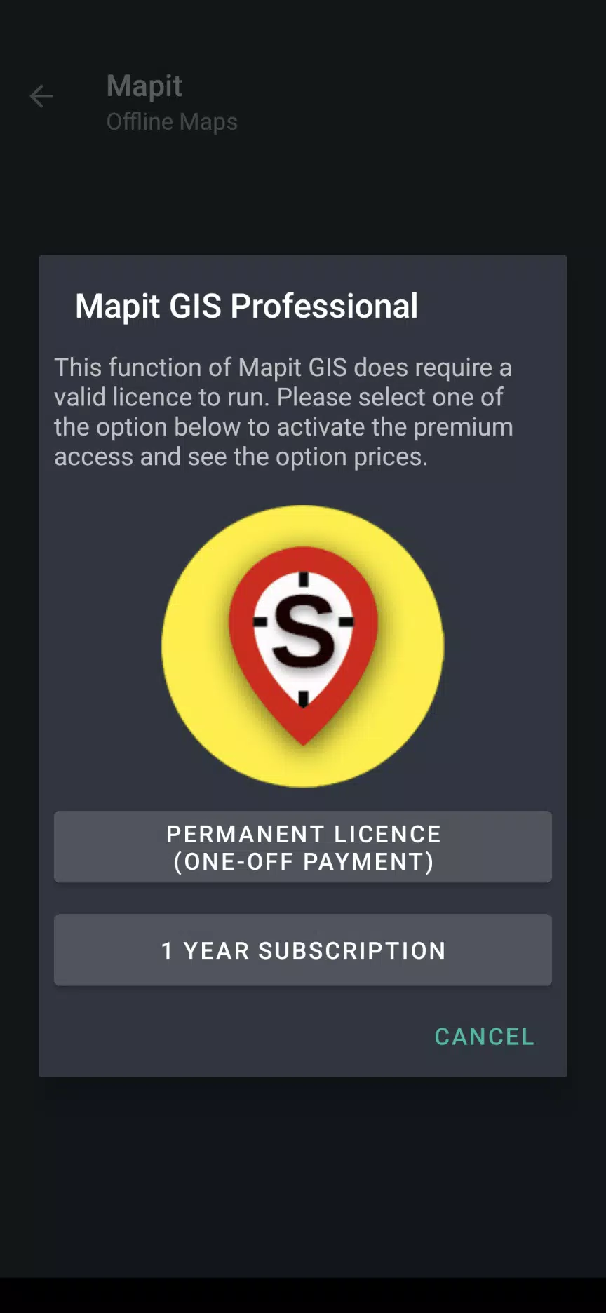
About Mapit GIS Professional
Mapit GIS Professional: A Comprehensive GIS Companion
Mapit GIS Professional is a next-generation GIS mapping application designed to revolutionize how you collect, manage, and analyze spatial data on your mobile device. Whether you're conducting environmental surveys, managing woodland resources, or planning solar panel installations, this app offers a suite of advanced features to streamline your workflows and enhance productivity. Built for Android 11+ users, Mapit GIS Professional combines cutting-edge technology with user-friendly design to provide unparalleled precision and flexibility.
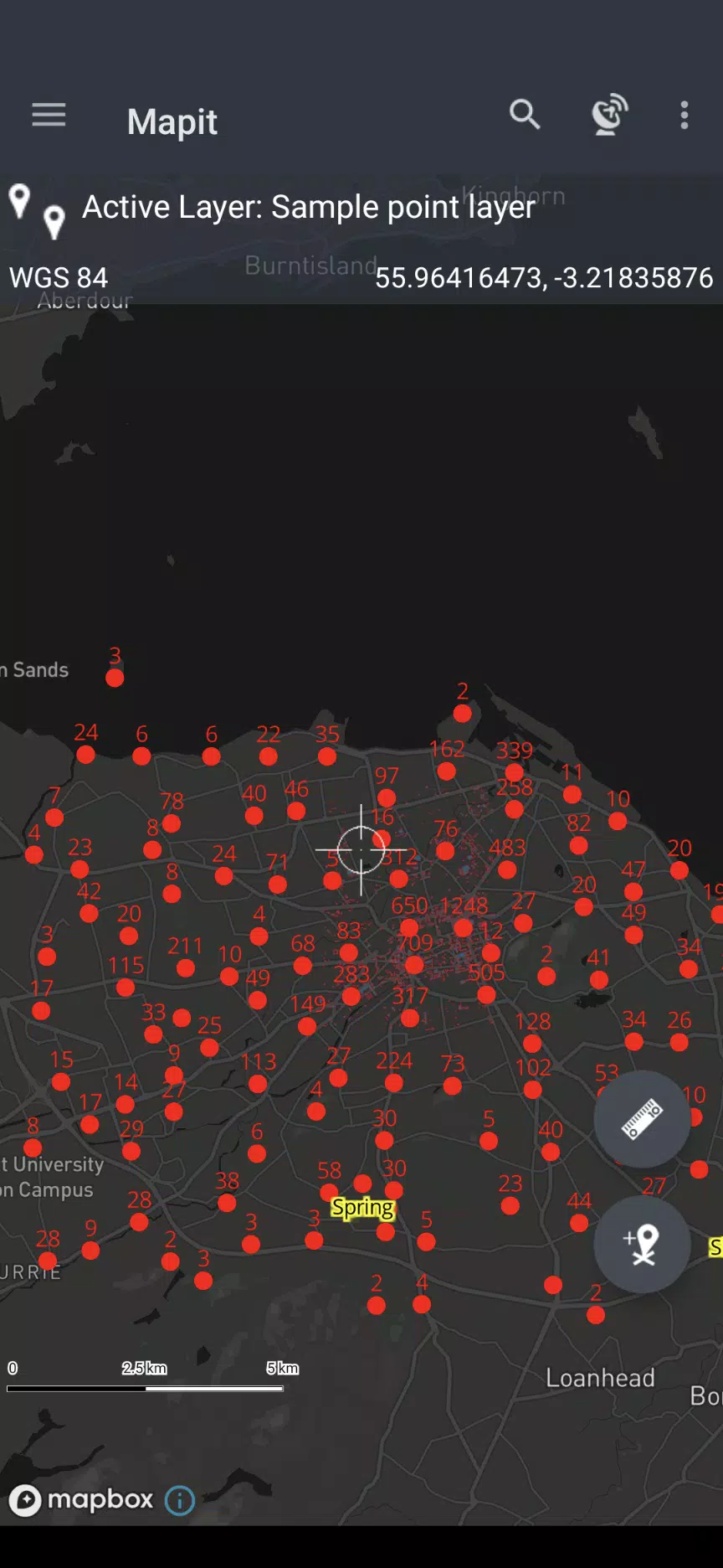
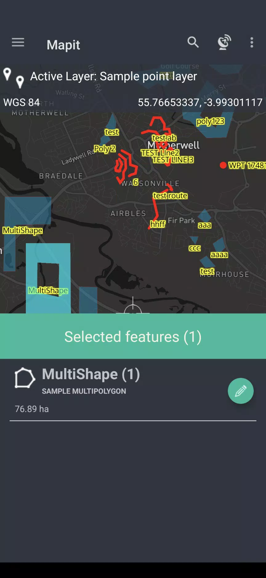
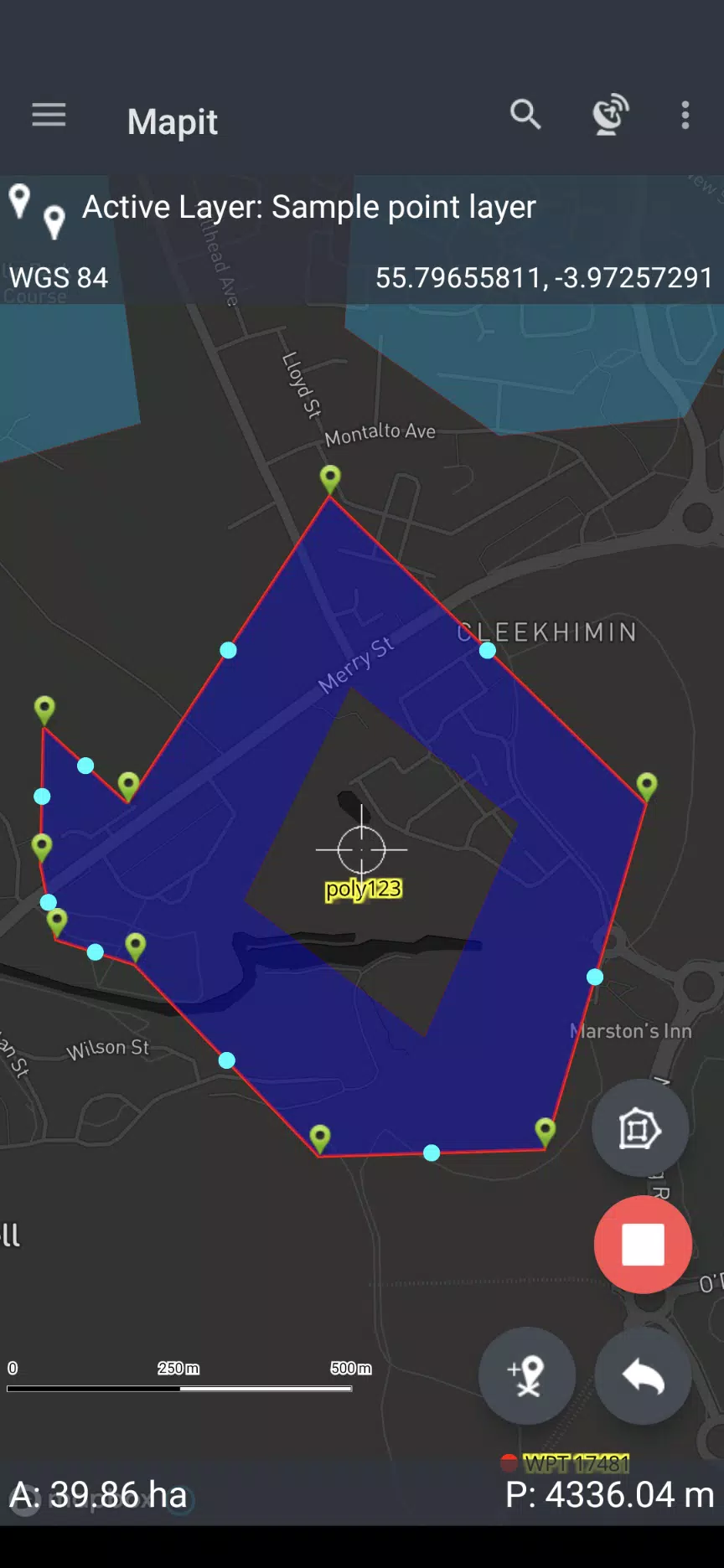
At its core, Mapit GIS Professional empowers users to measure distances and areas accurately using either map-based tools or GPS integration. This capability is complemented by seamless sharing options, enabling you to collaborate effortlessly with your team. The app's commitment to innovation is evident in its integration of the Mapbox SDK, which delivers stunning visualizations and robust mapping functionality. By leveraging detailed maps, users can ensure precise representations of their surveyed areas, making it ideal for professionals in industries ranging from agriculture to construction.
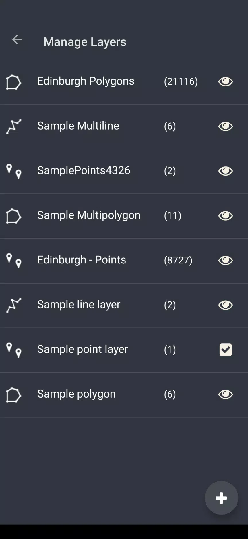
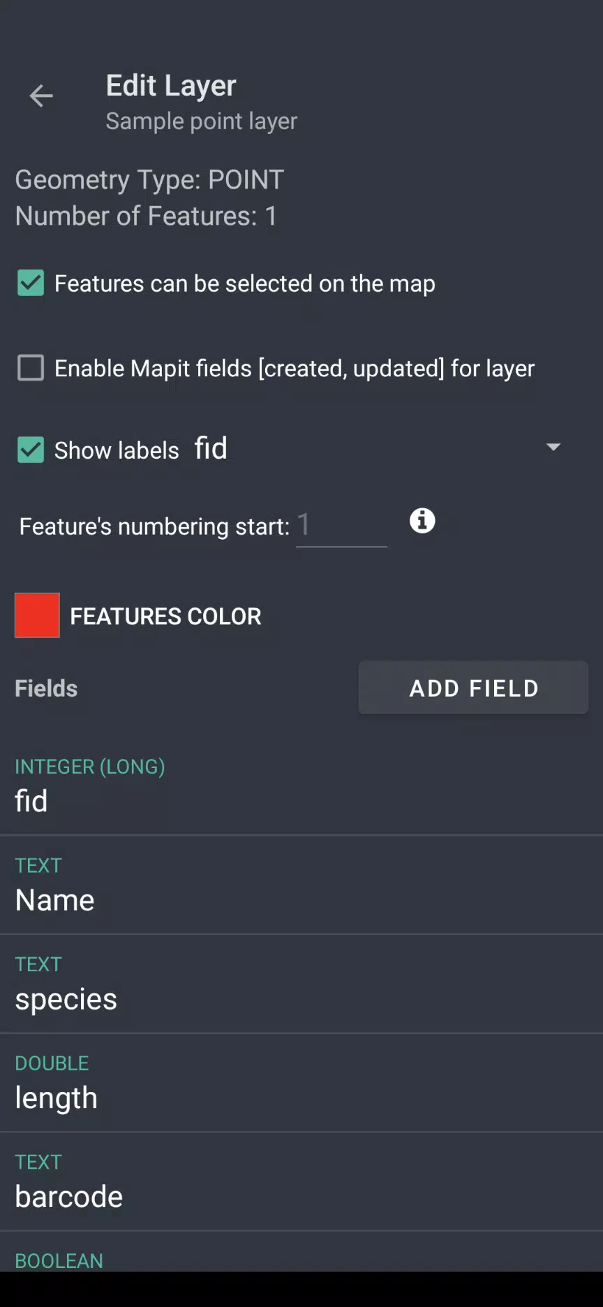
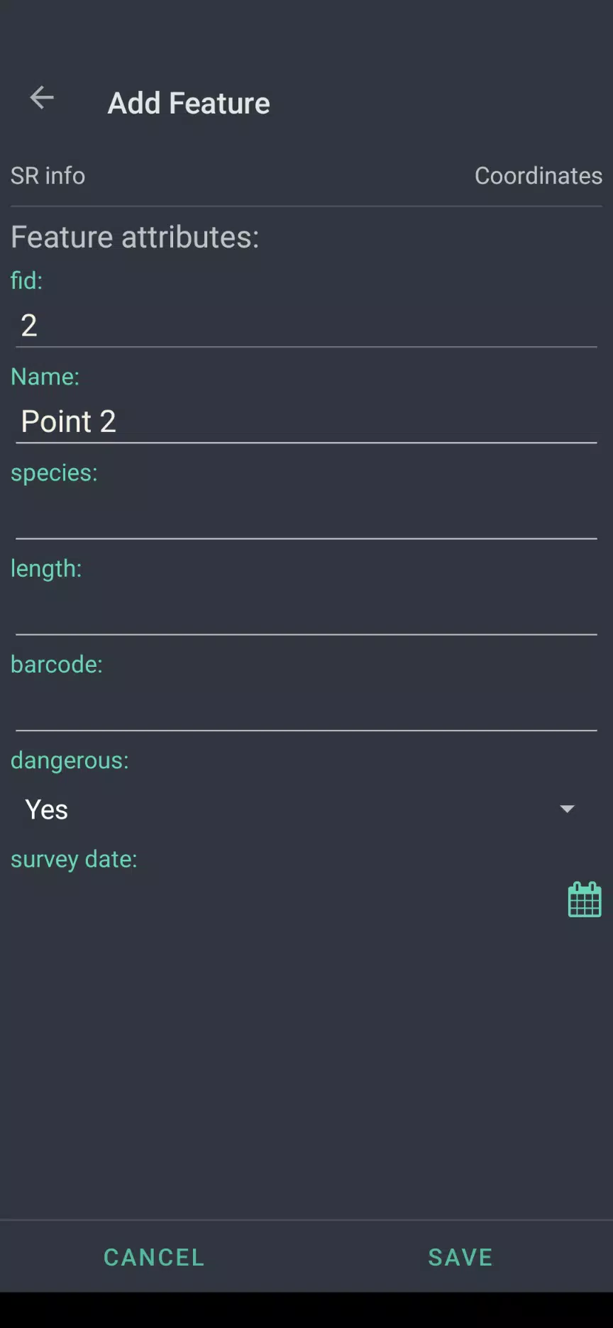
One of the standout aspects of Mapit GIS Professional is its efficient handling of geopackage projects. These projects allow users to manage their data seamlessly, optimizing survey design and enhancing collaboration across multiple applications. The app’s lightweight architecture ensures smooth performance even when dealing with complex datasets. Additionally, field linkage capabilities enable more effective data collection through customizable forms equipped with dropdown menus, multi-select lists, and barcode scanners. This customization ensures that each project aligns perfectly with specific requirements, improving both speed and accuracy during data entry.
Precision is another hallmark of Mapit GIS Professional. With support for multiple coordinate projections and the ability to specify default systems via EPSG codes, the app guarantees high accuracy across diverse environments. Furthermore, the inclusion of high-precision GNSS integration allows users to achieve centimeter-level accuracy by linking with top-tier GNSS systems. Features like real-time kinematic (RTK) solutions further amplify surveying capabilities, delivering industry-leading results.
Data exchange has never been easier thanks to Mapit GIS Professional’s versatile export and import options. Users can effortlessly transfer information between the app and other GIS tools in popular formats such as GeoJSON, KML, and CSV. This interoperability fosters seamless collaboration among teams working on shared projects. For those seeking greater control over their mapping experience, the app provides extensive customization options, including the addition of custom WMS and WFS services as overlays. Three distinct measurement methods are also available, ensuring reliable data capture under varying conditions.
The app redefines data management by offering a streamlined workflow that simplifies capturing, organizing, and analyzing spatial data. Its modernized approach caters to professionals across numerous fields, from land surveyors to tree specialists. Environmental surveys, road construction, roofing assessments, and snow removal operations—all benefit from the app’s powerful toolkit. As part of its ongoing evolution, Mapit GIS Professional remains dedicated to future improvements, promising continued enhancements aligned with evolving technological trends.
Looking ahead, Mapit GIS Professional continues to push boundaries within GIS mapping technology. While current iterations focus primarily on supporting Android 11+, future updates aim to reintroduce certain legacy functionalities phased out during transitions. Exciting developments lie just around the corner; keep an eye out for detailed plans outlined in our upcoming development roadmap scheduled for public release in Q1 2024. Until then, explore the transformative possibilities offered by Mapit GIS Professional today—your journey toward mastering precise spatial data management begins here!