| 1.0.0 (build ) | 1970-01-01 |
海拔地图 (Altitude Map) | APK Description
Discover the world from a whole new perspective with the 海拔地图 (Altitude Map) application! This innovative tool empowers you to explore topographical features and understand the elevation of various locations, whether you are hiking in the mountains, planning a new adventure, or simply satisfying your curiosity about the geography around you.
Key Features:
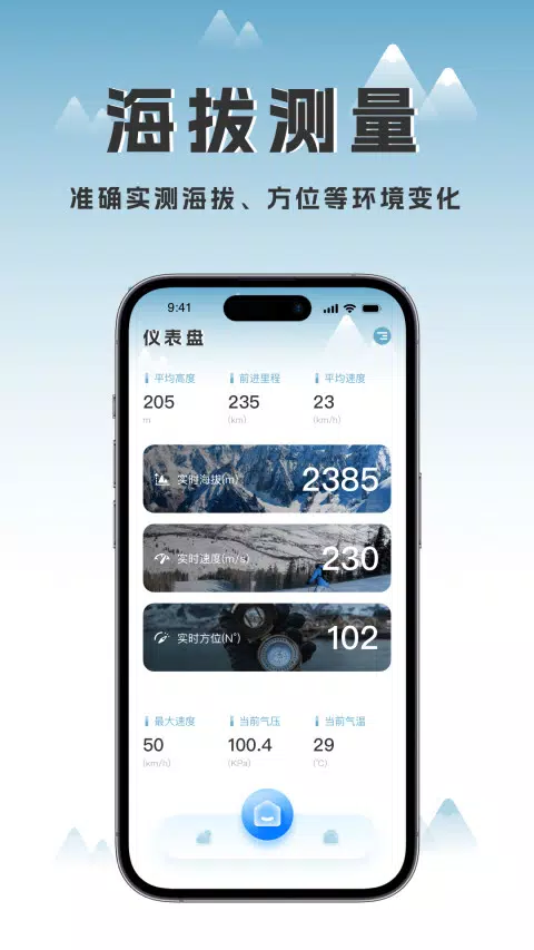
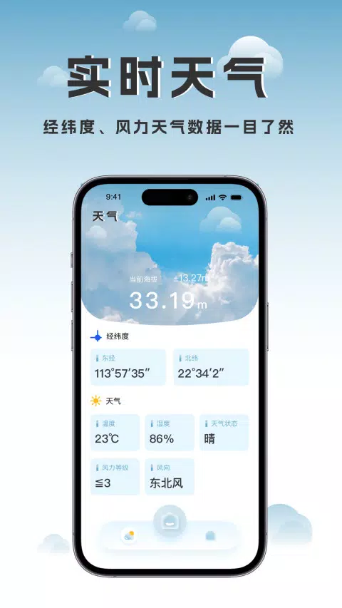
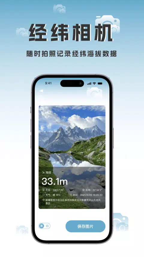
Detailed Elevation Data: 海拔地图 provides comprehensive elevation profiles for various terrains. Users can view the altitudes of specific locations and track changes in elevation across different routes, making it an essential companion for outdoor enthusiasts, travelers, and adventurers.
User-Friendly Interface: The application sports an intuitive and visually appealing interface that makes it easy for users of all ages to navigate. You can quickly zoom in and out on maps, switch between various view modes, and access information with just a few taps.
Interactive Maps: Explore interactive maps that update in real-time, allowing you to visualize elevation changes as you move. These maps can help users identify peaks, valleys, and other significant geographical formations, enhancing their understanding of the area.
Offline Capabilities: No internet connection? No problem! 海拔地图 allows users to download maps and elevation data for offline use. This feature is perfect for remote areas where connectivity may be limited, ensuring that you always have access to the information you need.
Create Custom Routes: Plan your hikes or biking adventures by creating personalized routes considering elevation changes. The app helps you assess the difficulty level of your chosen paths based on the elevation profile, allowing for better preparation.
Save and Share Favorites: As you discover new trails and locations, you can save your favorite spots within the app. Share your discoveries with friends and family, and inspire them to join you on your adventures.
Compatibility: The 海拔地图 application is designed to work seamlessly across various devices, ensuring that you can access necessary elevation data wherever you are. Use it on your smartphone or tablet while on the move or at home to plan future excursions.
Regular Updates: Keep your app current with regular updates that improve functionality and add new features. We listen to user feedback to make enhancements, ensuring that 海拔地图 remains the best tool for elevation mapping.
Use Cases:
Conclusion:
Unlock the wonders of geography with the 海拔地图 (Altitude Map) APK. Whether you're a dedicated outdoor lover, a professional planner, or simply someone with a passion for exploring, this app enriches your understanding of elevations and terrains. Download 海拔地图 today and take the first step toward a deeper connection with the great outdoors!
Download Now: 海拔地图 APK - Start your adventure today!
|
|
|

|
ส่งปัญหาที่คุณพบในขณะใช้แอปหรือคำแนะนำเกี่ยวกับแอปให้นักพัฒนา เพื่อช่วยพัฒนาแอปให้ดีขึ้น