The Chilterns Maps Offline
5Rating
Dec 3, 2018Latest update
1.1.1Version
About The Chilterns Maps Offline
From the producers of GB Maps (featured in Ordnance Survey's OS OpenData innovative application showcase)
Beautifully detailed maps supplied by Ordnance Survey.
Chiltern Hills Maps Offline provides a useful offline mapping reference and navigation aid whilst travelling throughout the area surrounding Ben Nevis by footpath, road, rail, loch and river. Intuitive route and waypoint management features are implemented enabling creation, modification, deletion, import and export of routes. A powerful offline search facility can locate places, roads, post codes and hills within the region. Worldwide online Apple maps (Standard, Satellite and Hybrid). Map features that you are used to with Apple maps are available on both offline and online maps as well as providing 3D buildings on Apple maps (where available).
Maps
7 different levels of offline 2014/5 Ordnance Survey map detail from national overview to street view within the region. (No data connection required)
Progressively more detailed maps are automatically loaded as the map view is zoomed. The OS recommended viewing scales for the more detailed maps are approximately as follows:
1:1000,000 (Whole of GB is covered)
1:250,000
1:50,000
1:25,000
1:10,000 ( Roads/streets are labelled)
The map region of the more detailed maps covers a rectangular region around the Chiltern Hills area.
- Contours with height information and annotated height points.
- Extensive footpaths from ©OpenStreetMap contributors
App
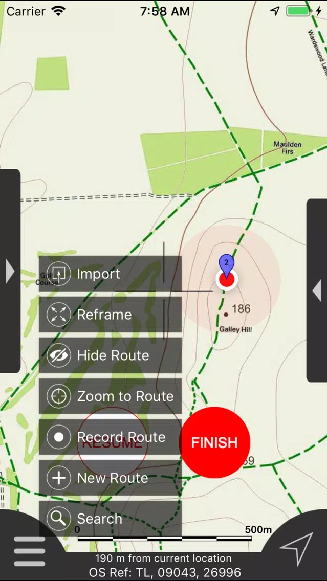
- Route/Waypoint management
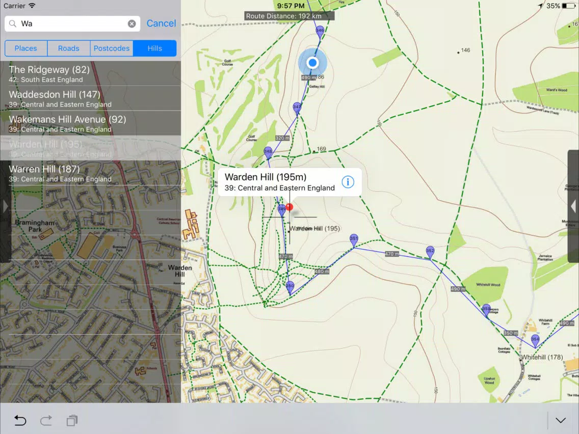
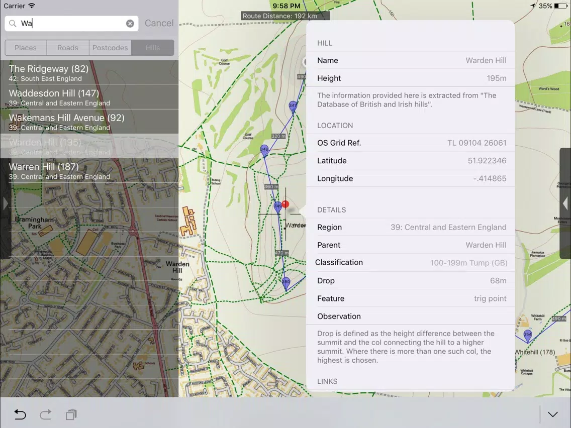
- Offline search functionality with searchable locations (places, roads, post codes and hills). (For the place search a location's latitude and longitude is accurate to 0.1 of a minute of the centre point of the 1x1 km National Grid square in which the name falls)
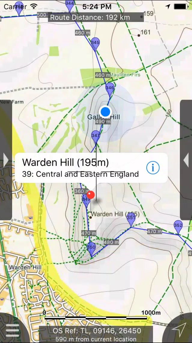
- Detailed hill information, including height, OS Grid Ref, latitude and longitude, region, parent, classification, drop and hill specific links to Streetmap, Geograph and Hill Bagging web sites
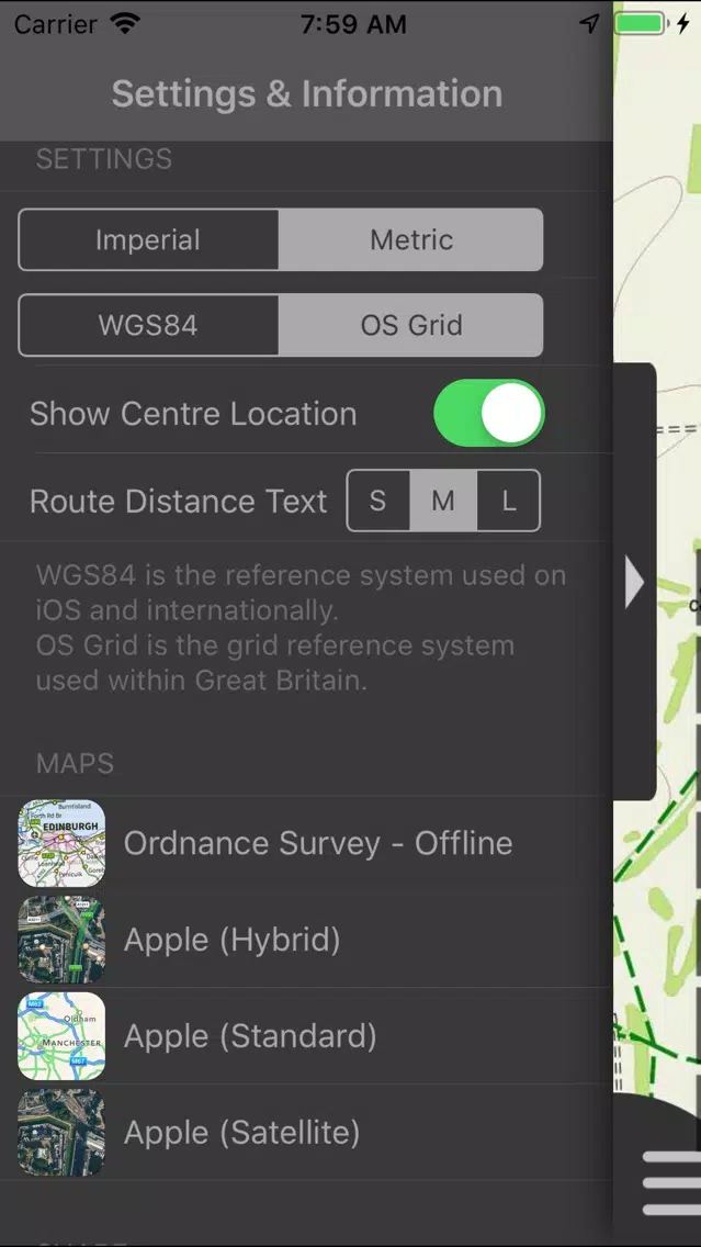
- Display of current GPS position as OS Grid Reference or WGS84 latitude and longitude
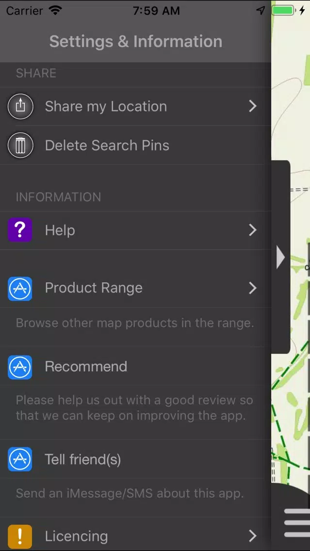
- "Share My Location" allowing users to share an image of their current location and location references. Buttons are provided to share location information by Facebook, Twitter, iMessage/SMS and e-mail
- Online access to worldwide Apple Standard, Satellite and Hybrid maps
- Apple 3D Buildings are displayed on Apple Standard maps
- Apple maps contain Points of Interest
- User location can be tracked with or without heading on all online and offline maps (GPS capable devices only)
- Display of scale bar in either metric or imperial units
- Display of current speed
- Zoom, pan, rotation of all maps
- Pitch of Apple Standard and Ordnance Survey maps
- Selection of current location annotation for display of speed and location data
- User setting for speed display in Miles per Hour (mph) or Kilometres per Hour (kph)
- Selection of search result pin annotations to display location information
- Collective deletion of search result annotation pins
- A user guide is provided within the app information
The OS search data was published by Ordnance Survey in 2016.
Extracts from "The Database of British and Irish Hills" v15.3 published 07/09/2016 (ref. www.hills-database.co.uk/index.html )
No warranty
The data is supplied by Apple, Ordnance Survey, contributors to OpenStreetMap and Database of British and Irish Hills.
The Information is licensed 'as is' and the Information Provider and/or Licensor excludes all representations, warranties, obligations and liabilities in relation to the Information to the maximum extent permitted by law.
The Information Provider and/or Licensor are not liable for any errors or omissions in the Information and shall not be liable for any loss, injury or damage of any kind caused by its use.
This app is not a substitute for a paper map and compass.
Beautifully detailed maps supplied by Ordnance Survey.
Chiltern Hills Maps Offline provides a useful offline mapping reference and navigation aid whilst travelling throughout the area surrounding Ben Nevis by footpath, road, rail, loch and river. Intuitive route and waypoint management features are implemented enabling creation, modification, deletion, import and export of routes. A powerful offline search facility can locate places, roads, post codes and hills within the region. Worldwide online Apple maps (Standard, Satellite and Hybrid). Map features that you are used to with Apple maps are available on both offline and online maps as well as providing 3D buildings on Apple maps (where available).
Maps
7 different levels of offline 2014/5 Ordnance Survey map detail from national overview to street view within the region. (No data connection required)
Progressively more detailed maps are automatically loaded as the map view is zoomed. The OS recommended viewing scales for the more detailed maps are approximately as follows:
1:1000,000 (Whole of GB is covered)
1:250,000
1:50,000
1:25,000
1:10,000 ( Roads/streets are labelled)
The map region of the more detailed maps covers a rectangular region around the Chiltern Hills area.
- Contours with height information and annotated height points.
- Extensive footpaths from ©OpenStreetMap contributors
App
- Route/Waypoint management
- Offline search functionality with searchable locations (places, roads, post codes and hills). (For the place search a location's latitude and longitude is accurate to 0.1 of a minute of the centre point of the 1x1 km National Grid square in which the name falls)
- Detailed hill information, including height, OS Grid Ref, latitude and longitude, region, parent, classification, drop and hill specific links to Streetmap, Geograph and Hill Bagging web sites
- Display of current GPS position as OS Grid Reference or WGS84 latitude and longitude
- "Share My Location" allowing users to share an image of their current location and location references. Buttons are provided to share location information by Facebook, Twitter, iMessage/SMS and e-mail
- Online access to worldwide Apple Standard, Satellite and Hybrid maps
- Apple 3D Buildings are displayed on Apple Standard maps
- Apple maps contain Points of Interest
- User location can be tracked with or without heading on all online and offline maps (GPS capable devices only)
- Display of scale bar in either metric or imperial units
- Display of current speed
- Zoom, pan, rotation of all maps
- Pitch of Apple Standard and Ordnance Survey maps
- Selection of current location annotation for display of speed and location data
- User setting for speed display in Miles per Hour (mph) or Kilometres per Hour (kph)
- Selection of search result pin annotations to display location information
- Collective deletion of search result annotation pins
- A user guide is provided within the app information
The OS search data was published by Ordnance Survey in 2016.
Extracts from "The Database of British and Irish Hills" v15.3 published 07/09/2016 (ref. www.hills-database.co.uk/index.html )
No warranty
The data is supplied by Apple, Ordnance Survey, contributors to OpenStreetMap and Database of British and Irish Hills.
The Information is licensed 'as is' and the Information Provider and/or Licensor excludes all representations, warranties, obligations and liabilities in relation to the Information to the maximum extent permitted by law.
The Information Provider and/or Licensor are not liable for any errors or omissions in the Information and shall not be liable for any loss, injury or damage of any kind caused by its use.
This app is not a substitute for a paper map and compass.
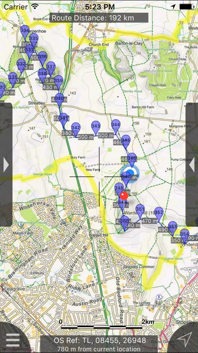
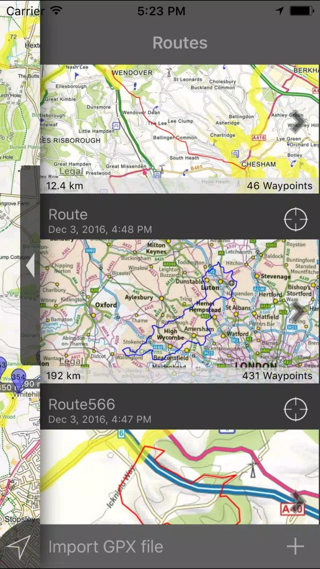
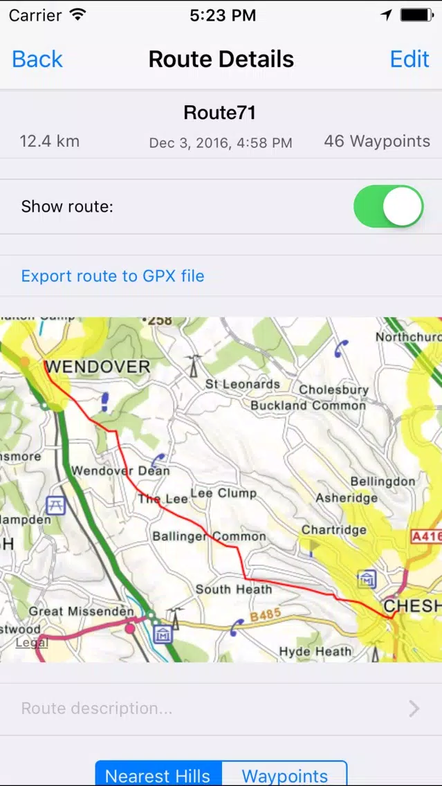
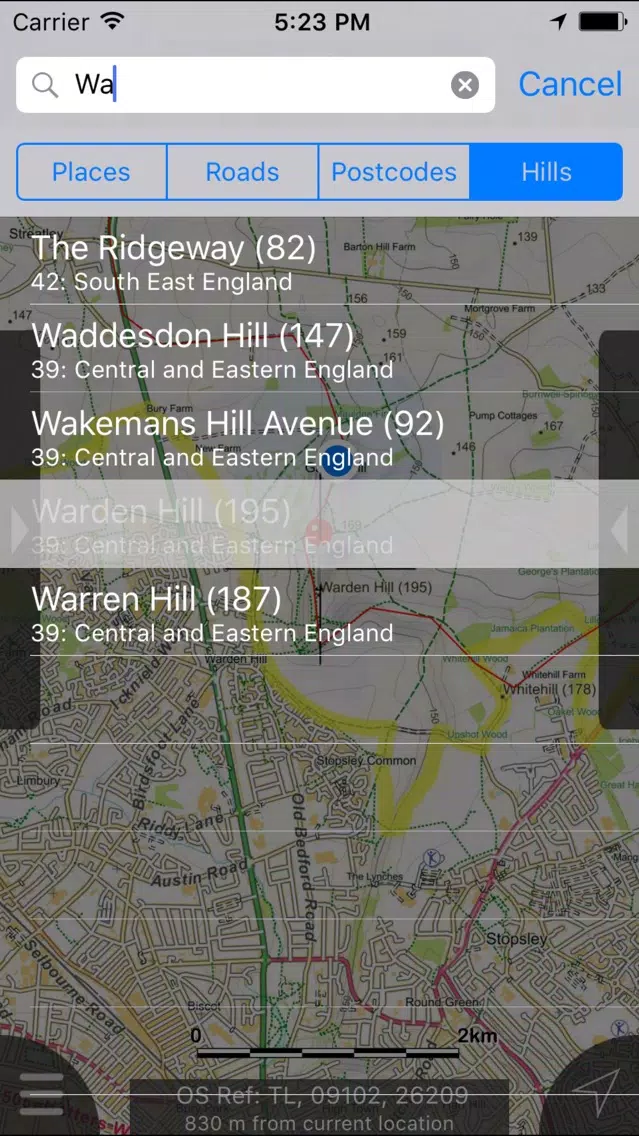
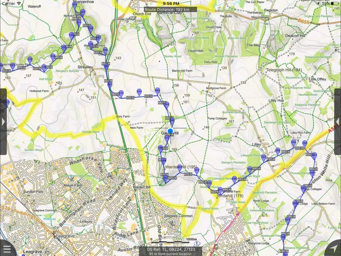
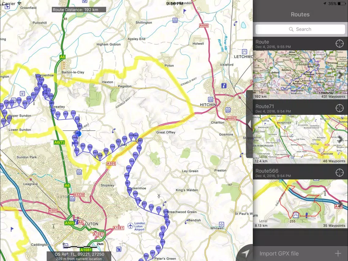
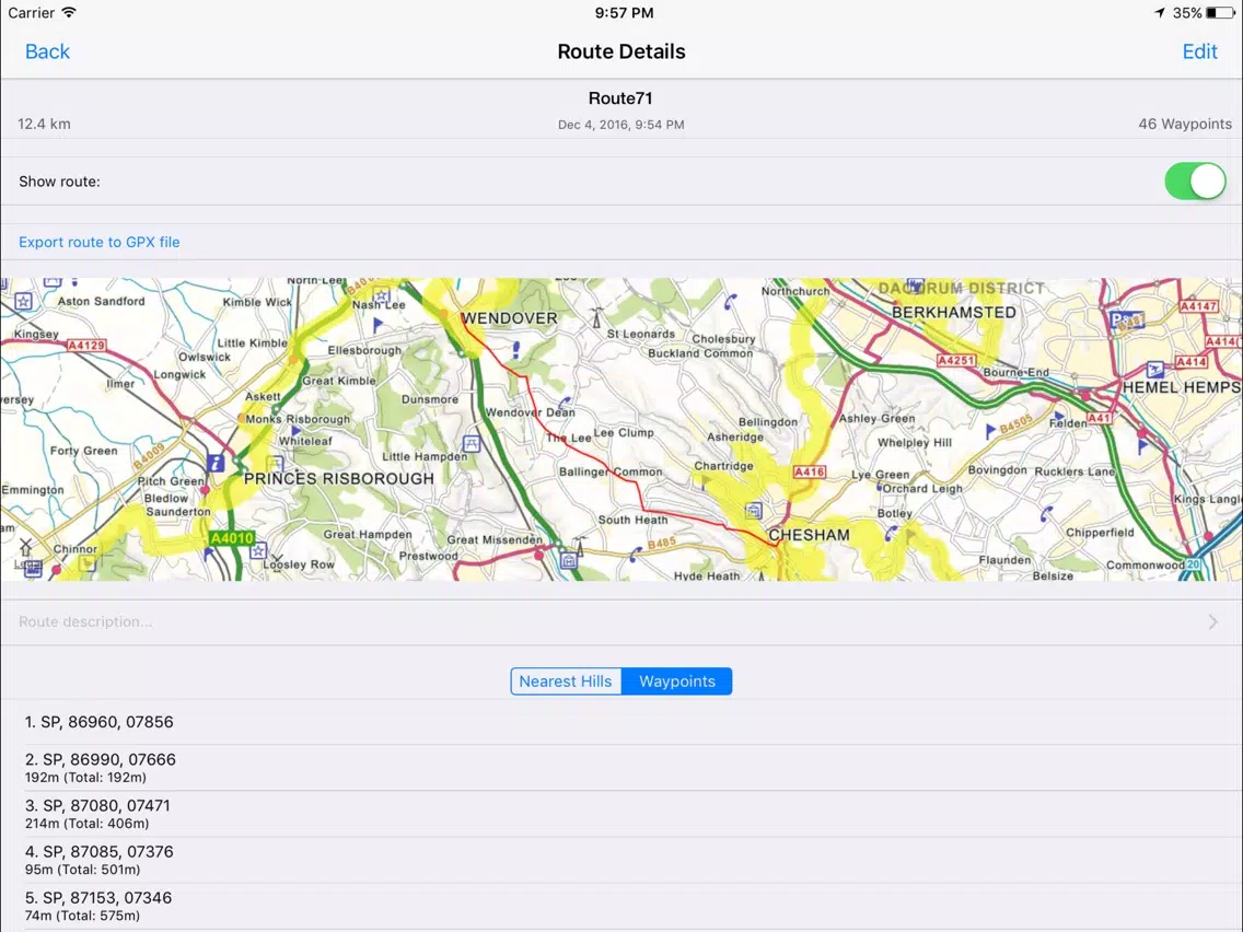
The Chilterns Maps Offline Screenshots
The Chilterns Maps Offline iPad Screenshots


Apps Like The Chilterns Maps Offline
 The Chilterns Maps Offline-
 Thế Giới Của Bé - Nhận Biết Thế Giới Xung Quanh-
 Cờ Thế Khó Nhất - Co The-
 Ví thẻ - Thẻ điện thoại giá rẻ-
 Tokyo Map offline - Japan Tokyo Travel Guide with offline city Tokyo Metro Map, Tokyo Bus Map, Tokyo Subway JR Trains Suica, Tokyo Maps lonely planet, Tokyo trip advisor maps-
 Philadelphia Maps - Download Rail Maps, City Maps and Tourist Guides.-
 Atlanta Maps - Download Transit Maps, City Maps and Tourist Guides.-
 Brussels Maps - Download Metro Maps, City Maps and Tourist Guides.-
 Geneva Maps - Download Bus Maps, City Maps and Tourist Guides.-
 Maps n Trax - Offline Maps, GPS Tracks & Waypoints1.0
 Good Maps - for Google Maps, with Offline Map, Directions, Street Views and More2.8
 4WD Maps - Offline Topo Maps2.3
The Chilterns Maps Offline FAQ
How do I download The Chilterns Maps Offline from PGYER IPA HUB?
Is the The Chilterns Maps Offline on PGYER IPA HUB free to download?
Do I need an account to download The Chilterns Maps Offline from PGYER IPA HUB?
How can I report a problem with The Chilterns Maps Offline on PGYER IPA HUB?
Did you find this helpfull
Yes
No
Most Popular
Sing It - Ear TrainerA must app for every musician, singer, or just for fun.
Test,train, and improve your musical ear an
Tube PiP - PiP for YouTubeTube PiP - the ultimate YouTube companion for iOS:
1. Picture in Picture (PiP) Playback: Watch YouT
Papaya Ouch!In the game Papaya Ouch!, you can experience backpack management, tower defense, TD, merge, match 2,
Lets Go VPNLets Go VPN, the most advanced VPN, is designed by a team of top developers who strive to ensure all
Paprika Recipe Manager 3Organize your recipes. Create grocery lists. Plan your meals. Download recipes from your favorite we
War Pigeons UnboundedWar is coming. Deep down in top secret military labs they have evolved, mutated - and escaped. The f
Procreate PocketApp of the Year winner Procreate Pocket is the most feature-packed and versatile art app ever design
Cowboy Westland survival runAre you ready to take part in the #1 exciting 3D western adventure? Cowboy Westland survival run mak
Max: Stream HBO, TV, & MoviesIt’s all here. Iconic series, award-winning movies, fresh originals, and family favorites, featuring
TonalEnergy Tuner & MetronomeFor musicians from pros to beginners, whether you sing, play a brass, woodwind or stringed instrumen
SkyView®SkyView® brings stargazing to everyone. Simply point your iPhone, iPad, or iPod at the sky to identi
Ninja Dash 2015Ninja Dash 2015 is the fast paced running game!<br>On these maze fields, rush to the end of this nin
Tami-Live Chat&VideoTami is an app that records daily life and ideas.<br><br>You can use it to record your every day, wh
SALE Camera - marketing camera effects plus photo editorSALE Camera Help you create the best Business to consumer Stock Photos and Images. provides 300 filt
DevTutor for SwiftUI"DevTutor" is an application designed to assist developers in creating exceptional apps using SwiftU
Mokens League SoccerDive into Mokens League Soccer and experience the new era of soccer gaming!
Esports for Everyone: W
Zombie ZZOMBIE ENDLESS RUNNER LIKES NO OTHER!<br><br>WHY?<br><br>* Awesome graphic quality!<br><br>* Simplif
Dead Z - Zombie SurvivalCatastrophic explosion at the Omega Labs started the apocalypse, now spreading across the Earth.
Ta
HotSchedulesHotSchedules is the industry's leading employee scheduling app because it’s the fastest and easiest
ChatGPTIntroducing ChatGPT for iOS: OpenAI’s latest advancements at your fingertips.
This official app is
Disney StoreDisney Store is your official home for exclusive collections, designer collaborations, and one-of-a-
fight back tennisa Pong game with Tennis style, the gameplay itself is very simple, you can using Touch. Ball speed w
Dr. Mina AdlyMina Adly mobile app provides students with portable instant access to a selection of services.
Usi
iVerify BasiciVerify Basic is your gateway to enhanced device security and threat awareness, offering a glimpse i